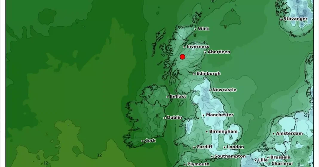
Temperatures are set to plummet this weekend as maps show where the mercury will fall furthest.
Conditions fell as low as -14C last week after heavy snowfall in parts of the country left roads cut off, schools closed and homes without power. The icy cold temperatures continued all week, before thawing to a milder 8-10C this week.
Millions of people are facing similar situations this weekend as WX Weather Maps show temperatures falling around England and into Wales. The maps show the mercury will fall in cities including Newcastle in the north east, Liverpool and Manchester in the north west, Leeds and the rest of West Yorkshire, the east of England and into the south on Saturday.
North Wales will also be a little chilly although Scotland seems to have been spared the freezing conditions. On Sunday, the cold will spread into Scotland with virtually all of England set to shiver in the cold conditions.
The maps show parts of Europe will also be frozen as major cities such as Amsterdam, Lille and Brussels will be a little colder than usual. The Met Office said of Friday to Saturday: “Some rain and often windy in the northwest. Mostly cloudy central and southern England, and sometimes Wales, with hill fog and patchy drizzle. Occasionally brighter elsewhere. Mild north, colder south.”
It adds for Sunday to next week: “This period is expected to see a transition, possibly lasting over several days, between the settled, dry, and often dull conditions expected over the next few days, to something more unsettled. Sunday itself is likely to be rather cloudy and cool, with outbreaks of rain in the west drifting slowly eastwards.
“The start of the following week will most likely see more settled conditions with light winds becoming re-established, with a chance of rain in both the far north and the far south, and a smaller chance that the rain could become more widespread. Later in the week, periods of much wetter and windier weather will most likely become more prevalent, from northwest to southeast, alternatively there is a very small chance of colder, drier, but perhaps wintry, easterly wind.”
Meanwhile, parts of the UK could see another blanket of snow later this month, according to advanced weather modelling maps. Brits in parts of northern England could be blasted with 15cm – six inches – of the stuff on the evening of January 27.
Maps from WXCharts, which uses Met Desk data, show the snow will be heaviest across the Pennines and into the Scottish Highlands.
The 1,000mile long wall of snow looks set to hit at around 6pm that evening. It comes amidst a temporary end to a bitterly cold snap of weather in the first full week of January.
Get email updates with the day’s biggest stories


